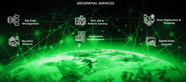
GEOSPATIAL SERVICES
Want to get your data spatially connected? We are here to help you out.
- Over 2 Decades of Existence
- Professionally Qualified GIS Engineers
- Expertise in AI / ML, Mobile and Web Applications Development and Deployment
- Domain Expertise in Over 100 Vertical Industry Segments
- Ability to Build Multilingual Applications.
- Heterogeneous Application and Technological Domains Expertise.
- Proven Capabilities for Data Digitization and Analytics
- We Provide You Complete GIS Assistance Driven by IT Solutions.
We have more than 20 years of experience in data digitization, data modelling, database management and big data analysis. Over these years, we have undertaken many projects in the area of GIS & GPS and our expertise in web and mobile application development is appreciated by our clients worldwide. We are one of the early birds who started employing Artificial intelligence (AI) and Machine learning (ML). We have built intelligent applications with inbuilt business logistics which get enriched with larger data over the passage of time to keep management well informed and assist them in better decision making.
We analyze, model, simulate and visualize events in an effective way to prioritize and deploy your valuable resources more efficiently in minimizing the impacts and risks, providing one stop solution for all your problems.
We will assist you in your endeavor to create intelligent and interactive maps and information system models to reveal spatial patterns that are embedded in large volumes of data to get better results in your applications.
Site
Geospatial Spatial Data Analytics
We offer Geospatial Spatial Data Analytics
Geospatial Spatial Data Analytics
Geospatial Big Data Integration Strategy Analytics on Demand Analytics on Unstructured Data Data Lake Solution & Services Big Data Service & Consulting Data Mining & Data Inferences
Data Visualization & Dashboarding Predictive Analytics Risk & Compliance Analytics Big Data Intelligence Cluster Analysis Intelligent Edge Text Analytics Big Data Strategy
Data Standardization Big Data Designing Big Data Engineering Big Data Development Data Mining Data Warehousing Online Analytical Processing (OLAP) Enterprise Data Optimization
Avoid Data Redundancy and Obsolescence Data Maintenance Spatial Data with The Easy Retrieval of Map Graphics Buffer Management, Clustering of Data, and Spatial access
Clustering Algorithms Database Finetuning Anticipate and Prepare for Possible Changes Move from Hindsight to Foresight Geospatial Analytics Spatial Change Detection and Management Utility Management Develop Targeted Solutions Identifying Key Factors for Solution Suggestion and Modification Threat detection More Engaging Insights for Decision Making Events and Trend Analysis Hydraulic and Hydrological Analysis Tracking and Harvesting records Geospatial Modelling Mobile Applications AI/ML GIS, GPS & RS Technologies Developing and Deploying Applications Under Cloud Environment. Web Applications Customised Solutions Integrations of GIS, GPS and RS Technology and Methodologies Variety of Database Management Systems Well Defined Software Engineering Processes Data Research Transcription Services Data Synchronizing Data Conversion Data Management Georeferencing Content Management Image Processing
e Catalogues Multimedia Authoring Digital Content Mapping Data Mapping
|
|
|
We can assist you to collect, analyse, manipulate, interpret, and report the geospatial data once your requirements are visualized and modelled to provide an integrated platform for your management needs.
We have resources who have adequate experience in using a wide variety of software platforms such as Java, C++, Python, MATLAB, SQL, SPSS, ARCGIS, ERDAS Imagine, ENVI, Google Earth Engine and variety of tools for GIS, GPS, Remote Sensing and Spatial Analytics.
We can provide end-to-end solutions to help you achieve your long-term business goals. We will leave no stone upturned while striving to help you with faster, efficient, and effective decisions.
|
|
|
The reliability and resilience of spatial data depends on the ability of the application to store, handle, and analyze spatial data that varies drastically from the conventional database management. We have the expertise to handle large database management systems, onsite and remotely with ensured timely access to authentic data for better decision making.
We help you to maintain the locational positions of objects in spatial or space-time systems along with the non-spatial attributes of the objects recorded and also compile layers of thematic data.
|
|
|
We can provide you with insightful information based on time and place as against the conventional information confined to rows and columns by adding the context of time and location to the traditional data.
Maps, which are created based on the Time Series Analysis will reflect the changes over time, as well as when and where the changes occurred. This can also extract meaningful statistics and other characteristics of the data. With the help of this data, it will be easy to recognize the patterns that were previously not available and at the same time making complex relationships understandable.
- Manage the Risks and Plan Better from the Historical Data
- Track Your Customers
- Efficiently Manage Your Sales Territories
- GIS based Information Management System
- Analyse, Locate, Suggest and Monitor Urban Expansion on Suitable Sites
|
|
|
We have the capability to develop intelligent applications using GIS, GPS, and RS technologies, either independently or in combination. Our experience lies in developing applications in broad range and wide degrees of complexity.
We can add intelligence, both accrued and new, to develop complex applications utilising the analytical capabilities of GIS and Remote Sensing. Our capabilities spread over 100 application domains and a wide variety of Technological domains allowing us to develop applications with programmed decision-making capabilities.
Interested to know more about Our Applications Development capabilities?
|
|
|
Historical data has a major role to play for effective decision making through spatial analysis and data digitization helps you through this. We help you to get your data analysed, visualized, modelled and digitize the entire data with over 2 decades of our unparalleled expertise in data digitization.
Interested to know more about Our Data Digitization capabilities?

